 RondoTrace
Satellite evidence for CSDDD, CSRD, CBAM and EUDR due diligence
Last updated:
In short
Satellite evidence supports due diligence under CSDDD, CSRD, CBAM and EUDR by giving a dated, independent record of what happened at a site in your value chain. RondoTrace measures forest loss, air quality, heat and other changes at named sites. The evidence supports your own assessment and does not replace the legal steps each law requires.
What the four laws ask for
| Law | The duty in brief | What satellite evidence adds |
|---|---|---|
| CSDDD | Companies in scope must identify and address adverse human rights and environmental impacts in their own operations, their subsidiaries and their chains of activities. | Dated observations of environmental change at sites in the chain, including sites you cannot audit. It does not show working conditions. |
| CSRD | Companies in scope report sustainability information according to the European Sustainability Reporting Standards. | Independent measurements to set beside what suppliers declare about their sites. |
| CBAM | Importers of cement, iron and steel, aluminium, fertilisers, electricity and hydrogen have reporting obligations, and buy and surrender certificates for the embedded emissions of the goods. | A check on whether a plant was operating, from its heat and night-time brightness. It does not measure embedded emissions. |
| EUDR | Cattle, cocoa, coffee, oil palm, rubber, soy and wood products must be shown by due diligence to be deforestation-free, which means not from land deforested after 31 December 2020. | Forest loss in a sourcing area, dated against the cut-off. It does not prove which plot your product came from. |
These summaries follow the European Commission's own pages on the CSDDD, the CSRD, CBAM and the EUDR, as they read on 19 November 2026. On that date they said that the CSDDD entered into force on 25 July 2024 with national measures applying from 26 July 2029, that CBAM has been in its definitive regime since 1 January 2026, and that the EUDR applies from 30 December 2026 for large and medium-sized operators and from 30 June 2027 for micro and small enterprises. Scope and timing have changed more than once, so check the current text for your own company. Our article on CSDDD and satellite monitoring goes further.
How it works in practice
You name the sites or sourcing areas that matter for a law, such as plantations and forest edges for the EUDR or mines and smelters for the CSDDD. We measure each on a regular cycle and give you a dated record with the images. Your team uses it to decide where to ask questions, where to send an auditor and what to put in the file.
A worked example: a palm oil area in Sarawak
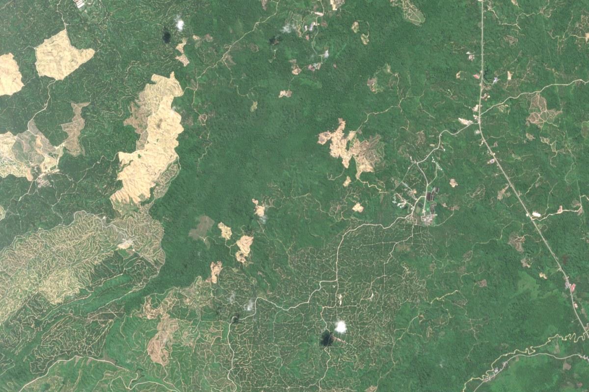
The Sarawak palm oil frontier in Malaysia is a sourcing area in our Outlook tool for sustainability teams. We measured 28 hectares of forest cleared in the six months to 30 April 2026 and 86 hectares in the six months to 31 October 2026, the most since 2021. Our record there starts in 2021, so all of it falls after the EUDR cut-off of 31 December 2020.
Several growers work in this area and we do not attribute the clearing to any of them. The record tells an importer that palm oil from here needs a closer look at plot level. It does not show which supplier buys from the cleared ground.
Limits
Satellite evidence cannot see workers, wages, land rights, contracts or finances, so it covers little of the human rights side of the CSDDD. It shows that forest was cleared and when, and it does not show who cleared it. It does not replace the plot geolocation and due diligence the EUDR requires, or the emissions data CBAM requires. Cloud and tree cover hide the ground. We do not predict incidents, and we do not say how likely one is.
Who uses this and for what
- Sustainability and compliance teams use it as independent evidence in a due diligence file.
- Procurement teams use it to decide which suppliers to question first.
Questions buyers ask
Is satellite evidence enough to meet these duties?
We describe it as supporting evidence. It helps you identify impacts at places you cannot visit and show afterwards how you did it. Whether it is enough for a given duty is a question for your legal advisers.
Can satellite monitoring prove a product is deforestation-free?
Not by itself. It can show whether forest was cleared in an area after 31 December 2020. Linking a shipment to a plot needs the plot locations from your supplier, which can then be checked against the record.
Does it help with CBAM emissions?
Only indirectly. We can show whether a plant's furnaces were giving off heat in a period, which is a check on reported activity. We do not measure the embedded emissions of a product.
You can try this on real sites in the Outlook tool, ask for a first reading of a site of your own at Check a site, or read Satellite monitoring compared with supplier audits, certifications and questionnaires.