 RondoTrace
Supplier site monitoring by satellite
Last updated:
In short
Supplier site monitoring by satellite means measuring a supplier's plant, mine or sourcing area from orbit on a regular cycle, without the supplier taking part. RondoTrace measures heat, air quality, built area, night-time brightness, forest loss and water at named sites, and tells you what changed there and when it changed.
What it is
A supplier site is the physical place where your supplier, or your supplier's supplier, makes or extracts something. Monitoring it by satellite means taking repeated measurements of that place from orbit and comparing them over time. The supplier does not fill in a form.
It answers plain questions about the place: whether the plant is running, whether it has grown, whether forest has been cleared around it, and whether the air around it has changed.
How it works in practice
We start from an address, a map pin or a site boundary, and choose the measures that fit the kind of site. A steelworks or smelter gives off heat that we record month by month. A factory under construction shows up as built area and as light at night. A mine or plantation shows up as forest loss and bare ground. A tailings facility shows up as wet area and, at the embankment, as ground movement measured by radar.
Every figure is compared with the site's own earlier years and with the land around it, so that a regional change such as a drought is not mistaken for something the site did.
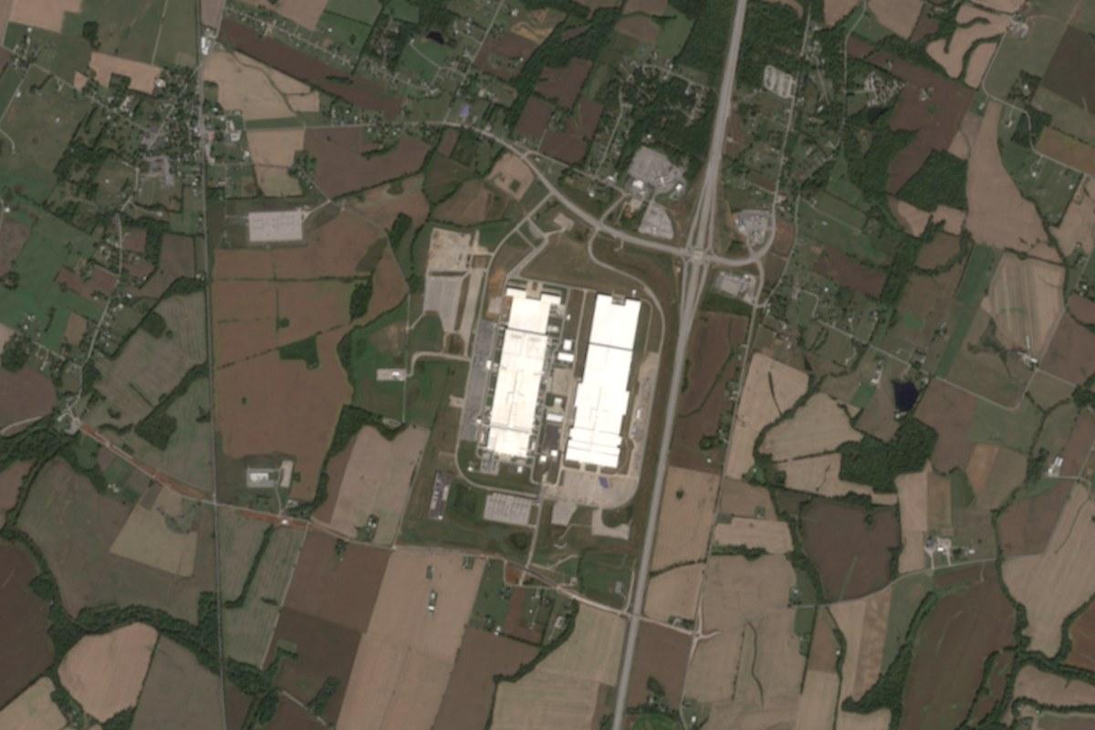
A worked example: a battery plant in Kentucky
The BlueOval SK battery plant at Glendale, Kentucky, is in our Outlook tool for insurers. Building reached its largest extent in 2024, with 149 hectares built on in a typical month, up from 93 in 2023. Between February and March 2025 the brightness reading at night fell from 41.6 to 20.4, and it has stayed near that level. In January to September 2026 the reading was 17.7, which is 61% less than in the same months of 2024.
The drop came five months before production was reported to start, which fits construction lights coming down. In December 2025 it was reported that the plant would close on 14 February 2026 for a refit and reopen in 2027. The satellite record gave the date of the change, and the public reports gave the reason.
Limits
A dimmer or cooler site tells you that something changed, not why. We cannot see inside a building, so we cannot count output, staff or stock under a roof. We cannot see contracts or finances. Cloud hides optical readings and tree cover hides the ground. Some measures are weak at some sites, and we say which. We do not predict incidents, and we do not say how likely one is.
Who uses this and for what
- Procurement teams use it to check that a supplier's plant is operating as the supplier says.
- Sustainability teams use it for forest loss and air quality around supplier sites.
- Insurers use it to see whether an insured site has changed since the cover was priced.
- Lenders use it to follow a plant that is still being built.
Questions buyers ask
Does the supplier need to take part?
No. The measurements are taken from orbit and from public sources, so we need only the location of the site.
What do we need to give you to start?
A name and an address, a map pin or a boundary. You can ask for a first reading of one site through Check a site.
Can you tell whether a plant has stopped production?
Often, for sites that give off heat or are lit at night. A furnace that goes cold or a site that turns dim can be measured. For a plant whose work happens under a roof with no heat to record, we can see the building and its lights but not its output.
How far back does the record go?
It depends on the measure. In our public examples the brightness record and the images both start in 2021.
You can try this on real sites in the Outlook tool, ask for a first reading of a site of your own at Check a site, or read Which supply chain risks satellite monitoring can detect, and which it cannot.